-
AI Automation services
Cybersecurity
Cloud services
MVP Development
Full-stack Development
Custom Applications
QA & Software Testing
-
Engineering Services
-
Discover how Polosoft streamlines strand map drafting with advanced technical workflows—boosting accuracy, efficiency, and project turnaround like never before.

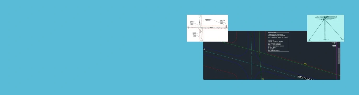
The foundation of strand map drafting begins with accurate placement. We use field data, GIS layers, and engineering standards to place critical infrastructure components like poles, pedestals, anchors, guys, and grounding elements. Each element is positioned with precision to reflect real-world locations, topography, and existing structures.

To maintain consistency and readability, our drafting follows industry-standard strand symbols. Each device - be it a pole, pedestal, anchor, or grounding point is represented using universally recognized symbology. This allows engineers, contractors, and field teams to easily interpret the maps and work with confidence.

Strand maps are not just visual references, they integrate directly with utility data and regulations. We align our design output with utility-specific standards, whether it’s electric, telecom, or broadband infrastructure. Our team ensures compatibility with utility mapping systems and supports seamless integration with GIS and asset management platforms.

An accurate Strand BOM (Bill of Materials) is essential for budgeting, procurement, and scheduling. Our drafting service includes the automatic generation of BOMs that list all components required for a project—cables, poles, anchors, straps, hardware, and more.

Our strand mapping services incorporate GPS data for precise geo-referencing of each facility. We use GPS-enabled field data collection tools to accurately locate poles, anchors, and other infrastructure elements. This allows for seamless integration with GIS platforms, asset tracking systems, and mobile applications.

The “unload” phase refers to importing and processing field-collected data into drafting platforms. We handle the conversion of field data (from GPS tools or mobile apps) into CAD or GIS tools, ensuring accuracy and alignment with base maps. This phase is critical for transforming raw survey data into usable strand map layouts.

losoft Technologies offers Pole Strand Map Permitting Design and Drafting services that ensure seamless integration with regulatory compliance standards. Their solutions are tailored to support telecom and utility companies in planning and designing pole and strand infrastructure, providing accurate maps and detailed documentation required for permitting.
Before final delivery, every strand map undergoes a detailed review process. This includes visual inspections, cross-checking against field notes, and running quality assurance checks for geometry, symbology, and material counts.


Our QA/QC ensures your design is error-free, field-ready, and aligned with project goals.
At Polosoft Technologies, we specialize in strand map drafting that supports reliable network builds and infrastructure planning. From symbol accuracy to material planning and GPS precision—we’ve got it covered. Contact us today!
To increase high levels of productivity, Polosoft Technologies provides Point Cloud Classification services for various industries.


Whether you need to streamline a process or develop apps fast, we're here to help.
Contact Us

 AI &
Automation
AI &
Automation
 QA & Software Testing
 Cybersecurity
 Cloud Services
 MVP Development
 Custom
Applications
Custom
Applications 


 Engineering Services

 Digital Branding
 Industries


 Home
Home