Shaping a Smarter Future with Possibilities of Geospatial Data
Polosoft Technologies provides crucial data annotation and labeling that can power your geospatial application and projects of your industry.
Our expert annotators meticulously label data, ensuring your maps, GPS systems, and location-based applications work flawlessly, guiding users with pinpoint accuracy. Our data annotation services can fuel your AI and Machine Learning algorithms, enabling them to recognize and predict location-based patterns and trends accurately.
Improve logistics, resource management, and planning by using the information from our geospatial data, which are essential for optimizing routes, reducing costs, and increasing efficiency. Ready to discover the untapped possibilities of precision in geospatial data annotation? Choose Polosoft for all your geospatial data needs.
Our services cover different annotation types, from images to key points, polygons, and more. With our precise labeling and annotation, your data becomes clearer and more valuable for navigation, object recognition, and decision-making.
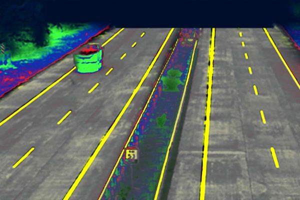
In image annotation, our experts meticulously label and annotate objects, landmarks, and relevant features within images. This provides a rich context and clarity to geospatial data, making it invaluable for navigation, object recognition, and visual analysis. Whether it's identifying road signs for autonomous vehicles or marking landmarks for urban planning, we ensure precision in every annotation.
Keypoint annotation is about identifying and labeling specific points or coordinates within an image. These annotated key points serve as critical reference markers for geospatial applications. Whether it's pinpointing crucial geographic features on a map or specifying critical points for navigation, our annotation ensures the precision needed to drive accuracy and efficiency.
Polygon annotation involves meticulously outlining objects or areas within geospatial images to define their boundaries. This precise outlining is invaluable for tasks like land-use planning, property demarcation, and environmental monitoring. We ensure that your geospatial data is enriched with clear, well-defined polygons for a more comprehensive view of your location-based information.
Polyline annotation focuses on annotating lines, routes, and pathways within geospatial data. These annotations are essential for navigation and routing applications, helping to optimize travel and logistics. We provide detailed polyline annotations that improve the accuracy and efficiency of route planning and navigation systems.
Semantic segmentation is all about classifying and labeling each pixel within an image, making it an invaluable tool for object detection and analysis. With our annotation services, we provide a comprehensive understanding of the objects and elements in your geospatial data, allowing for more precise and data-driven decisions.
Image segmentation divides images into distinct regions, simplifying complex visual data for applications such as land-use planning and environmental monitoring. Our services include accurate image segmentation, providing clear boundaries for regions within your geospatial images, and allowing for detailed analysis and decision-making.
Our precise bounding box annotation services significantly enhance object recognition, tracking, and a wide range of applications across various industries. Whether it's for improving the safety and efficiency of autonomous vehicles or enabling precise object tracking in wildlife monitoring, our bounding boxes empower AI and machine learning models to make better decisions and drive innovations.
LiDAR data annotation is a crucial component in the development of 3D maps, object recognition, and autonomous vehicle technology. We specialize in annotating LiDAR data, ensuring that 3D models and autonomous systems have accurate and reliable information for safe and efficient operations.
We help AI systems recognize objects, understand spatial relationships, and categorize content in geospatial images with precision. From autonomous vehicles to environmental monitoring, our annotated data makes AI and ML applications more accurate and effective.
For Artificial Intelligence (AI) systems, accurately recognizing and understanding objects in a geospatial context is fundamental. Our image annotation services, including key points, polygons, and semantic segmentation, provide the annotated data that helps AI systems make sense of their surroundings, whether it's identifying objects for autonomous vehicles or understanding geographical features in urban planning.
AI and machine learning models rely on precise spatial data. Keypoint and polyline annotation enable models to understand spatial relationships within geospatial data, enabling more efficient route planning for navigation applications or better land-use analysis for urban planning.
Semantic segmentation allows AI models to categorize and understand the content of geospatial images at a pixel level. This fine-grained annotation is invaluable for applications that require granular data analysis, from environmental monitoring to precision agriculture.
Polosoft Technologies is your trusted partner in the world of Geospatial Data Annotation Services. We specialize in providing the essential data annotation and labeling that power your geospatial applications and drive success in your industry. Our precise image annotation, key points, polygons, semantic segmentation, and more contribute to improved object recognition, enhanced spatial analysis, and semantic understanding. Our geospatial data annotation for AI and machine learning results in improved logistics, resource management, and planning. Join us on this journey to explore the untapped possibilities of location-based data, and let us help you shape a smarter and more efficient future.
Q: How do your services cater to both large enterprises and startups?
A: Our scalable services can be tailored to fit your specific requirements, whether you're a well-established enterprise or a dynamic startup. We offer flexibility and competitive pricing, ensuring that our services are accessible to businesses of all sizes.
Q: How can your geospatial data annotation services benefit autonomous vehicle projects?
A: Our services provide accurate labeling of road signs, lanes, and objects, enabling AI systems to make informed decisions and navigate safely. This is essential for the development and safety of autonomous vehicles.
Q: What industries can benefit from your 3D LiDAR Point Cloud Annotation services?
A: Our 3D LiDAR annotation services have broad applications, including autonomous vehicles, urban planning, and environmental monitoring. The precise annotation of 3D point clouds is a game-changer for industries reliant on spatial data for accurate modeling and decision-making.
Q: Can you handle geospatial data annotation projects with specific language or region requirements?
A: Yes, our services can accommodate language or region-specific needs. We have experience working on projects with diverse language and regional considerations, ensuring that our annotations align with your project's objectives.
Q: How do your services contribute to environmental sustainability and resource conservation?
A: Our precise geospatial annotations can contribute to more efficient resource management and sustainable practices in various industries. By optimizing routes, reducing costs, and improving planning, our annotations can lead to a reduced environmental impact. We are committed to contributing to a more sustainable future.
Whether you need to streamline a process or develop apps fast, we're here to help.
Contact Us