-
AI Automation services
Cybersecurity
Cloud services
MVP Development
Full-stack Development
Custom Applications
-
Engineering Services
-
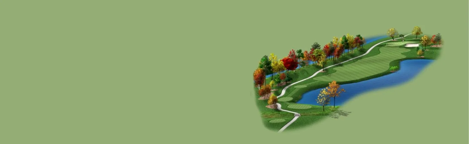
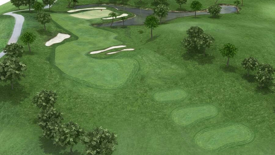
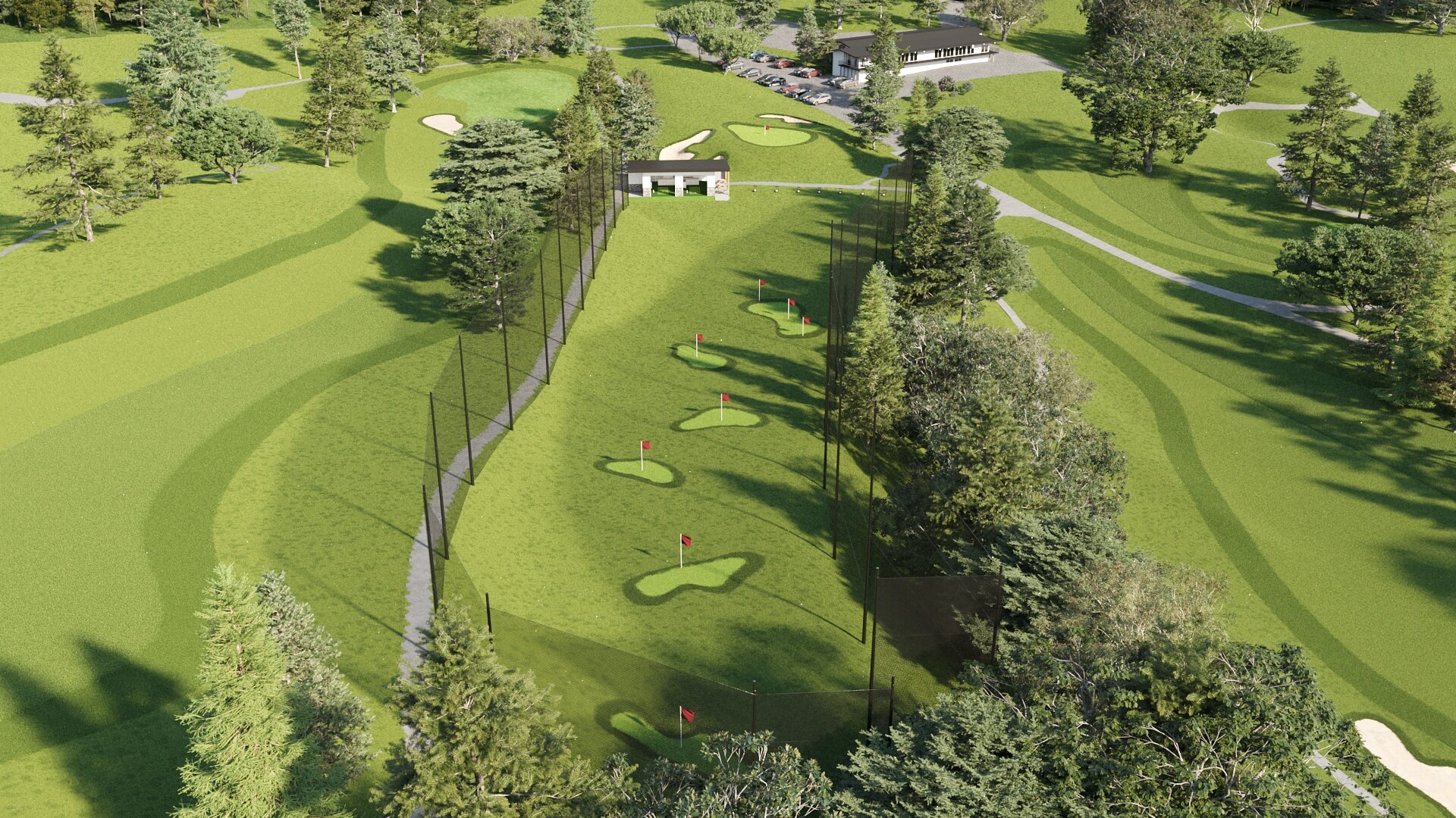
Modern geographic information system (GIS) has a significant impact on the mapping and management of geographic facts and figures. With 3D visualization of the golf course, golf course owners can better visualize and manage the course. Golf industries including designing courses and facilitating management get huge benefits through 3D modeling in GIS. Every major area of a golf course, including the fairways, pipelines, bunkers, golf holes, greens, tees, and machines, is depicted in 3D modeling.
Planning another golf land needs a precise intuitive 3D model. We at Polosoft Technologies are skilled at creating 3D visualizations of golf courses. We create golf course graphics and 3D flyovers with our team of experts. We help you effectively manage, process, and integrate massive point collections of 3D data by providing a wide range of videos and making use of terrain data. The golf course map makes it possible to quickly measure areas, control pin positions, drain, bunker, and irrigate pipelines and manage pin positions.

Because it accurately records terrain and vegetation data, 3D modeling is cost-effective for developing and mapping out golf course greens, tees, bunkers, drainage projects, and environmental management. Get 3D topo guides of the highs and lows of the territory.

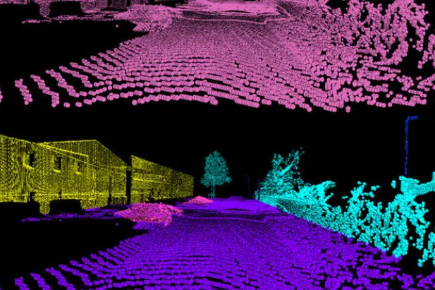
3D models made from data from aerial surveys are used to manage and monitor greens and make better decisions about how to spend money on the costs of maintenance. Facility management can benefit from maps and spatial data provided by LiDAR and imagery data

The golf course and its surroundings are simply presented in great detail so that players can imagine the strategy. In addition, the inclusion of GIS mapping improves the display of the 3D model and provides the right information.

We help take game design to the next level, allowing golfers to navigate a 3D or topographical model of a golf course and access multiple layers of information to aid understanding.
Polosoft's Golf course 3D modelling is a complex process involving various stages and technologies. Here's a breakdown of the key steps
Polosoft's Golf course 3D modelling creates exceptional layouts that challenge and delight players while preserving the natural beauty of the environment. It's a fusion of art and science, resulting in golf courses that are not only visually stunning but also provide an unforgettable golfing experience.
To increase high levels of productivity, Polosoft Technologies provides Point Cloud Classification services for various industries.


What is Golf Course 3D Modelling?
Golf Course 3D Modelling is the process of creating three-dimensional visualizations of golf courses using geographic information system (GIS) technology. It involves mapping and modeling various elements of the golf course, such as fairways, greens, bunkers, tees, and irrigation systems, to provide a detailed and interactive representation of the course.
What are the benefits of Golf Course 3D Modelling?
Golf Course 3D Modelling offers several benefits. It allows golf course owners and managers to better visualize and manage the course, make informed decisions about maintenance and design improvements, and provide an immersive experience for players. It also helps in marketing the golf course by presenting detailed and realistic visuals to potential players.
What services are included in Golf Course 3D Modelling?
Golf Course 3D Modelling services typically include flyover 3D videos, hole and green graphics, course overview illustrations, yardage books, scorecards, pin placement management, irrigation system maps, topographic maps, and interactive tours. These services provide a comprehensive solution for visualizing and managing the golf course.
How does Golf Modelling aid in game planning?
Golf Course 3D Modelling enhances game planning by allowing golfers to navigate a 3D or topographical model of the golf course and access multiple layers of information. This helps golfers understand the layout of the course, strategize their shots, and make more informed decisions during gameplay.
How can I connect with Polosoft for Golf Course 3D Modelling services?
To connect with Polosoft for Golf Course 3D Modelling services, you can call them at 503-928-5984 or email them at their provided email address. They will be able to provide you with more information about their services and discuss your specific requirements for golf course visualization and management.


Whether you need to streamline a process or develop apps fast, we're here to help.
Contact Us

 AI &
Automation
AI &
Automation
 QA & Software Testing
 Cybersecurity
 Cloud Services
 MVP Development
 Custom
Applications
Custom
Applications 


 Engineering Services

 Digital Branding
 Industries


 Home
Home