-
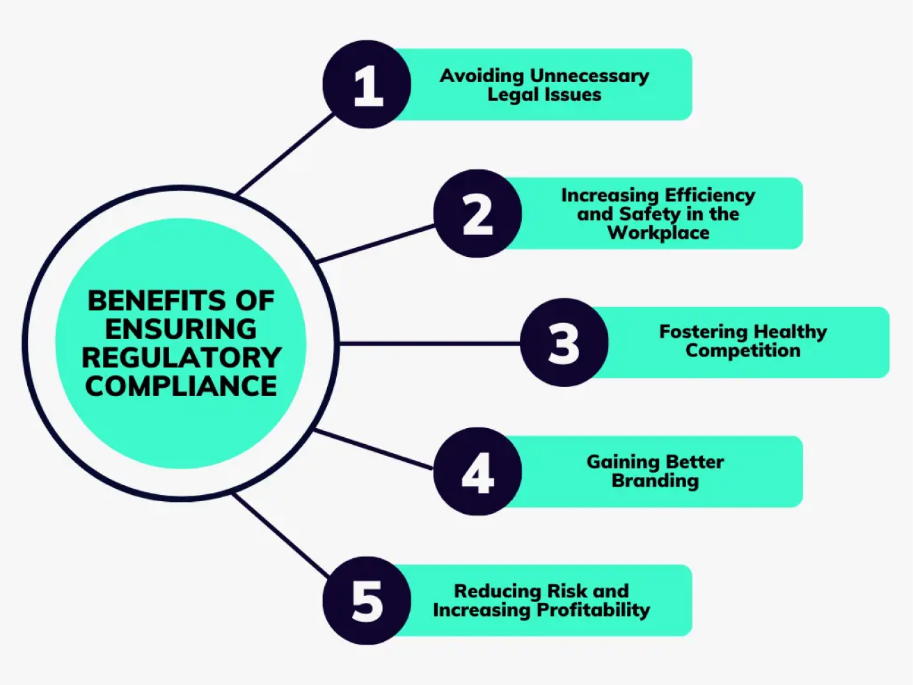
AI Automation services
Cybersecurity
Cloud services
MVP Development
Full-stack Development
Custom Applications
-
Engineering Services
-
Professionals are skilled in providing GIS services tailored to your specific business needs. Being in the market as a GIS consulting firm is not an easy challenge, but Polosoft Technology has been in the sector for a while and we now precisely know what a GIS project needs right away.
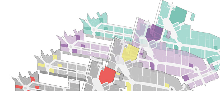
As the characterization of a map and its components are employed in a way that would notably depend on the output image of the GIS mapping, every industry requires GIS maps generated with various data. It is crucial to comprehend the industry's necessities as well as all of its future demands.
Consultants in geographic data systems are responsible for managing digital mapping data and performing analysis to address any and all geographic questions. Making maps that are derived from analytical knowledge for our clients is our primary focus as a GIS consulting service. We provide GIS services and have years of expertise serving a range of disciplines and companies.
Geographical information systems (GIS) consulting services cover a range of specialized solutions that can benefit businesses in a variety of sectors.
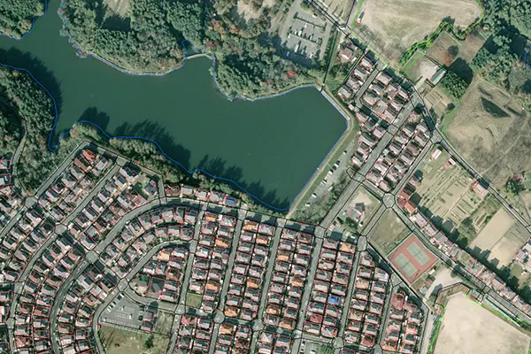
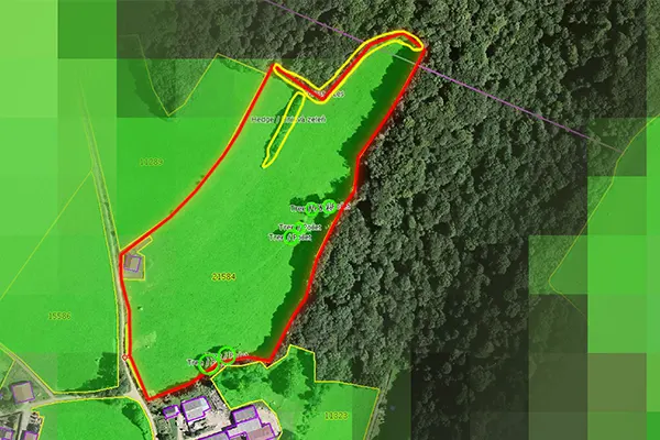
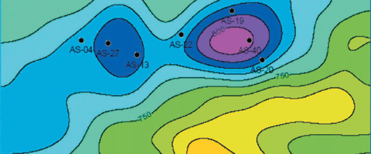
Map concentrations, or an amount normalized by space or overall range, can be visualized by placing map components on a piece of paper in a way that takes real-world considerations into account.
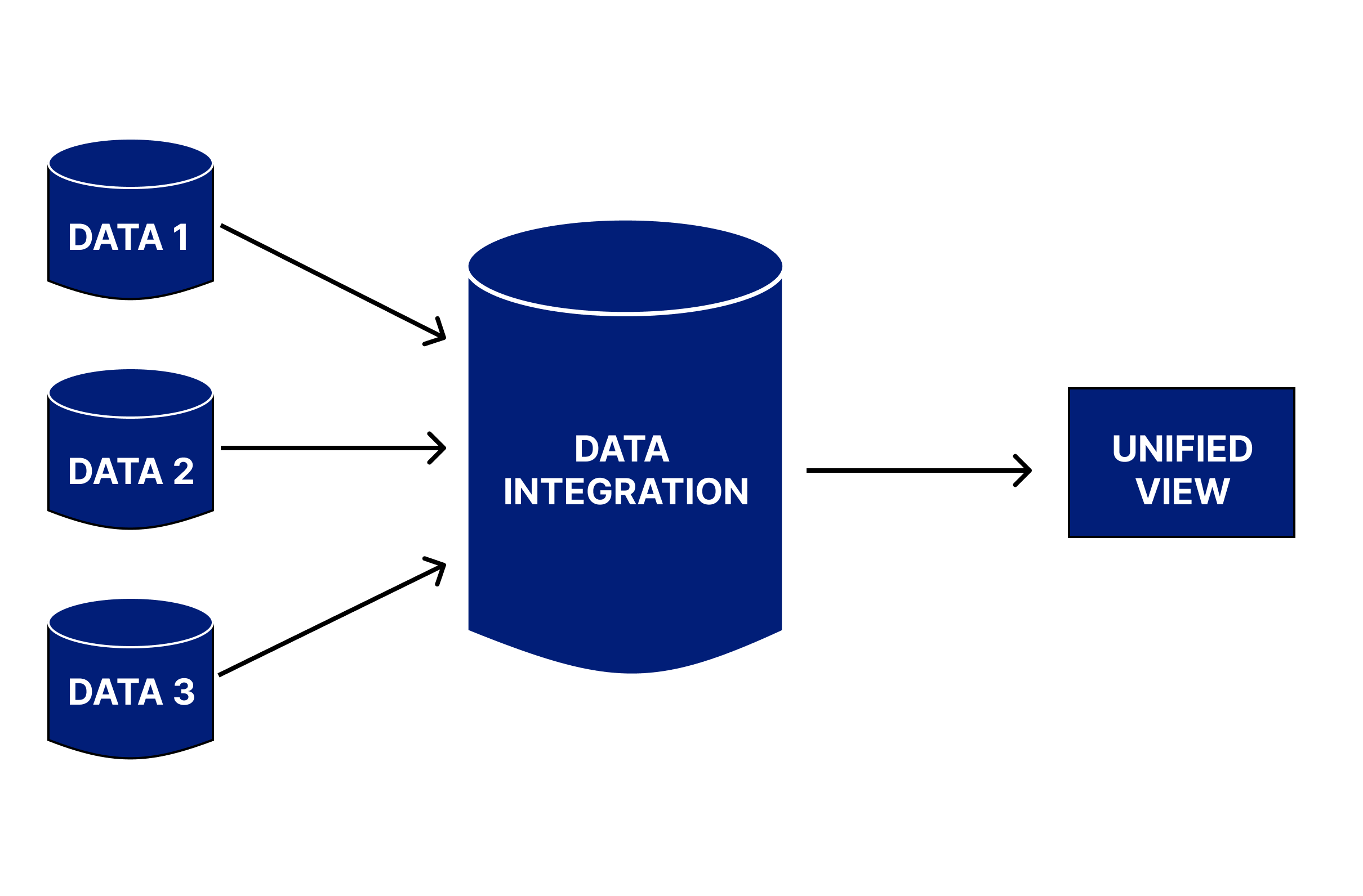
We convert info into a digital format. This approach divides the information into discrete units that will be discussed in turn. Information is easier to distribute, access, and preserve when it is digitalized.
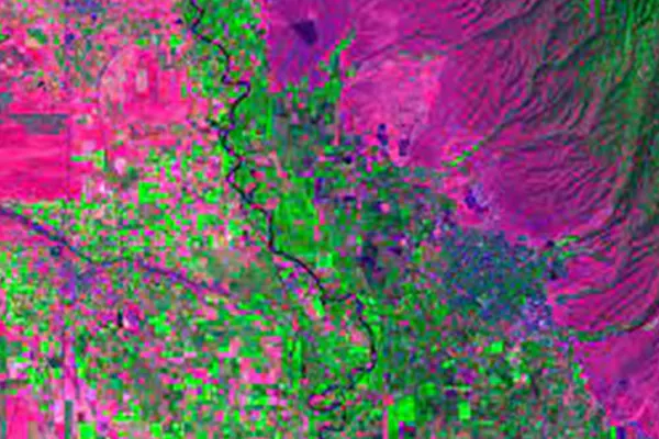
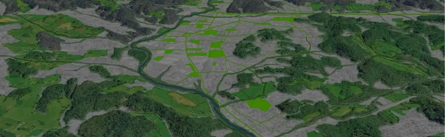
We work in sectors that offer services including satellite imagery for earth observation, natural resource boundaries, land use, and environmental monitoring. giving a clear, succinct, and accurate illustration of the course of events.

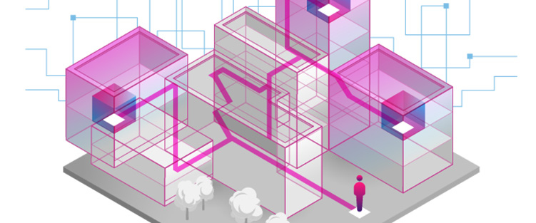
Applications for GIS might range from access to GIS tools to knowledge of GIS. We have experience developing ESRI-based mostly mobile applications and might supply development services across desktop, internet, and mobile platforms.
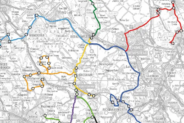
An in-depth study employing GIS knowledge and other materials, together with customer consultation, are the first steps in our cartography and custom-making process. Then, before production and printing, we frequently move on to design, 3-D modeling, style, and knowledge overlays.
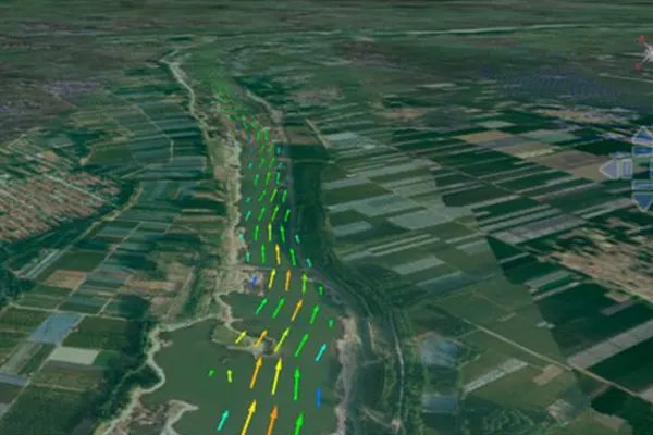
In addition to GPS data and satellite photos, geospatial analytics also collects, processes, and visualizes knowledge from geographic information systems (GIS). For a lot of accurate modeling and trend predictions, they frequently develop spatial models and knowledge representations.
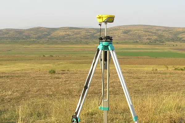
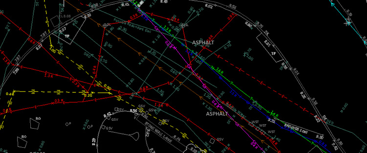
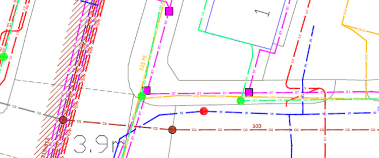
To establish the relative positions of points or other physical information for the gathering of spatial field data, Polosoft offers the necessary data dimensions. For survey data collecting and mapping solutions, we employ the most recent technology and equipment.
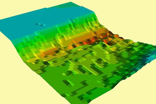
Polosoft is profound when it comes to the geospatial information production chain, with satellite images for earth observation, delimitation of natural resources, land use, and environmental monitoring. We pledge to provide services with the utmost accuracy.
Utilizing the full potential of geographic information systems (GIS) to assist organizations in making more informed decisions requires a comprehensive and strategic approach.

Polosoft Technologies will value what you would like for a GIS program by conducting comprehensive assessments of the package, hardware, data, staffing desires, and management needs. In collaboration with your organization, we will look for the most effective ways to use GIS technology to boost performance. By giving you the resources and information to achieve this, we help you make recognizable special selections.

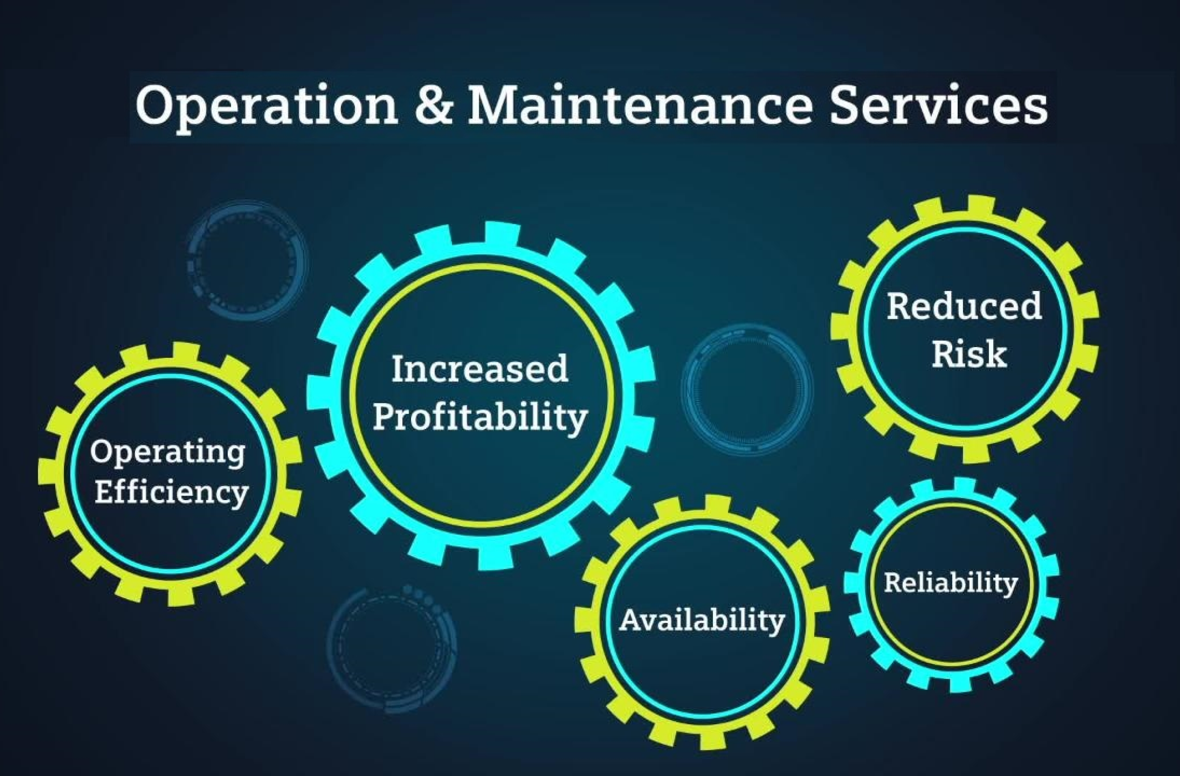
Polosoft Technologies can offer ongoing structural leadership in managing workflows similarly to managing employees and personnel from the beginning of every task and throughout the course of the project life cycle. Eliminating information redundancies and distributing data fairly is the primary focus of project management of the data flow and communication between key participants. To ensure the project's success, everyone must maintain a consistent page.

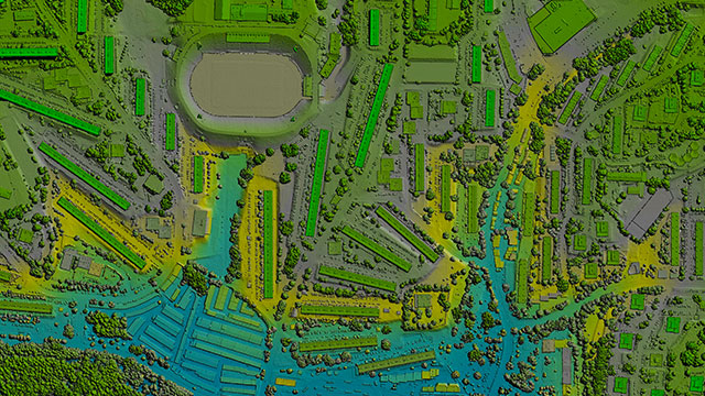
Finding the frequently complex correlations between multiple spatial data is where GIS really shines. GIS mapping services is a helpful tool for understanding geographical relationships because it uses a number of analytical techniques collectively known as spatial analysis. Additionally, spatial modeling will be used to automate the analytical process, enhancing the analysis's efficacy.
Polosoft’s GIS offshore project management offers advanced spatial technologies to enhance the planning, execution, and operation of offshore projects, ensuring they are carried out efficiently, safely, and sustainably.


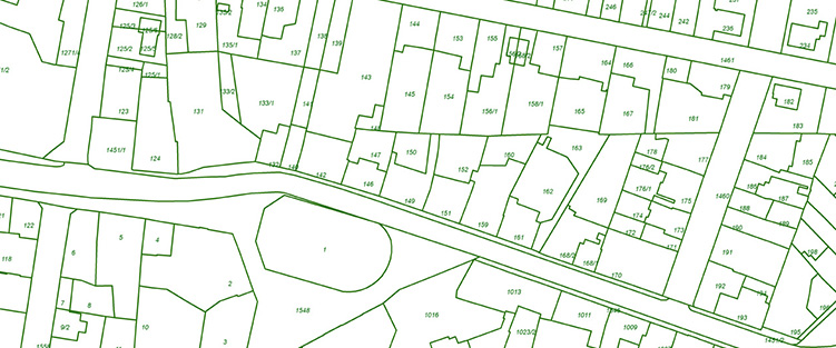
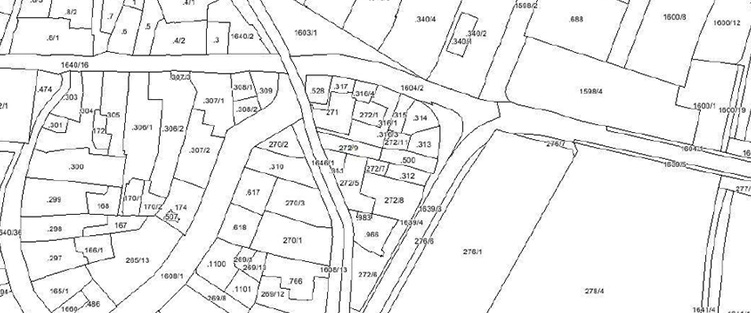
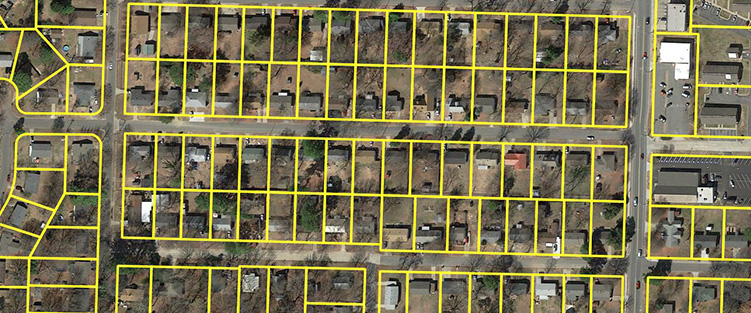
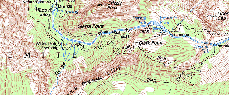
A leading GIS company, Polosoft Technologies specializes in services for the field of cartography. For various Government and corporate agencies, Polosoft Technologies offers advanced GIS mapping & Analysis, Remote sensing data processing services, LiDAR services, Photogrammetry, CAD engineering, land survey drafting , and LiDAR classification, among others, to assist with project planning.
To increase high levels of productivity, Polosoft Technologies provides Point Cloud Classification services for various industries.


What is GIS consultancy?
GIS consultancy helps in mapping, modeling, and analyzing location-based datasets. It helps companies visualize your data, providing expertise in a highly specialized field.
What does a GIS consultant do?
GIS consultant manages digital mapping data and performs analysis of geographical statistics. GIS consultants make maps for clients, deduced from analytical data.
What services are included in GIS consultancy?
GIS Mapping. Data Digitization. Digital Photogrammetry. Remote Sensing. Data Conversion. Web & Mobile Application. Pole Loading Analysis. Cartography.
What are the advantages of GIS consultancy?
GIS technology paces with current trends, analyzing the acquired data and creating impact on the future of your business. With multiple maps in layers displaying datasets along with relevant information.
What companies need GIS consultancy?
GIS integrates geographic intelligence into the planning process, increasing situational awareness by real-time data available to businesses. Assists in effective planning and also promotes better allocation of resources.

Polosoft Technologies is a provider of GIS consultancy services. Its GIS consultancy team can offer a single GIS consultant for lesser assignments or a qualified team of consultants for extensive GIS enterprise consulting. All of our GIS experts have experience offering GIS mapping services tailored to specific industries, which can help you with your project and company needs.
We create GIS web and mobile apps that are completely market-dominant and offer GIS services in the sectors of Utilities,Supply chain management, Urban planning, Forestry and Timber.


Whether you need to streamline a process or develop apps fast, we're here to help.
Contact Us

 AI &
Automation
AI &
Automation
 QA & Software Testing
 Cybersecurity
 Cloud Services
 MVP Development
 Custom
Applications
Custom
Applications 


 Engineering Services

 Digital Branding
 Industries


 Home
Home