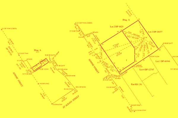
Mapped, Managed, and Mastered the Highway Corridor to Progress
Polosoft Technologies proudly offers a suite of services designed to optimize, streamline, and transform the way highway road corridors are planned, built, and maintained. Whether you're a government agency, a civil engineering firm, or a construction company, our expertise in Geographic Information Systems (GIS) and Light Detection and Ranging (LiDAR) data services can significantly enhance your operations, drive cost-efficiency, and deliver unparalleled results.
From route planning to environmental impact assessments, our state-of-the-art solutions provide the information needed to create safer, more efficient transportation networks. For government projects, our services support better urban planning, reduced traffic congestion, and enhanced disaster response capabilities. For engineering and construction firms, the result is improved project accuracy, cost reduction, and accelerated timelines. By choosing us, you will get dedication to innovation, accuracy, and exceptional customer service.
Through our LiDAR and GIS data expertise, we ensure the highway road corridor is designed with the utmost efficiency, safety, and environmental responsibility. From road mapping and 3D scanning to topographical analysis and urban planning, get the best of our geospatial data services.
Our data collection methods include GPS, remote sensing, and detailed field surveys. We ensure real-time data accuracy through advanced technologies such as LiDAR and aerial imagery. This data covers an extensive range, from traffic flow and pavement conditions to land use, weather, and environmental factors. Our commitment to precision guarantees that you have the most reliable data at your disposal.
Our GIS experts are dedicated to transforming complex data into highly detailed and visually intuitive maps and representations. These maps offer a window into the intricate details of your corridor, providing invaluable insights that streamline your decision-making process. Whether you're searching for suitable expansion areas, dissecting traffic patterns, or pinpointing potential challenges, our services will empower you to make well-informed and efficient decisions.
Our experts leverage state-of-the-art technologies to model geospatial data, enabling optimized route planning and land use management. This isn't merely about drawing lines on a map; it's about identifying the most efficient, sustainable, and environmentally responsible solutions. We meticulously evaluate the available data to determine the best routes that minimize environmental impact while enhancing the overall sustainability and efficiency of your corridor design.
Our LiDAR technology goes beyond traditional surveying methods to capture detailed, highly accurate 3D scans of the corridor, translating reality into precise point cloud models. These models are indispensable for project success, allowing you to make design decisions with unparalleled measurement accuracy.
With LiDAR data, we embark on a comprehensive topographical analysis of the terrain that your corridor will traverse. This thorough analysis ensures that the road aligns seamlessly with the landscape. The result is a road corridor design that reduces the potential for instability, minimizes environmental disruption, and ensures a harmonious coexistence with nature.
Our LiDAR data services extend to precise mapping of vegetation and obstructions along the corridor. We go beyond merely identifying them; we provide detailed maps that guide the design of road corridors with the least possible disruption to the natural environment. Every step of our approach is focused on creating corridors that are not only safe and efficient but also respectful of the delicate balance of the ecosystems they traverse.
Our environmental impact assessments are comprehensive and meticulous, addressing local, regional, and national regulations. We analyze the potential effects of road corridor projects on ecosystems, wildlife, water bodies, and nearby communities. Our goal is to help you not only comply with environmental regulations but also minimize harm to the environment and make informed decisions.
In urban planning, our GIS expertise is a valuable asset in optimizing road networks to alleviate traffic congestion and enhance safety. We scrutinize traffic patterns, congestion points, and urban development to design corridors that improve the flow of goods and people.
During emergencies, our GIS services provide real-time data, aiding in swift and effective disaster response. We offer crisis management tools that monitor road conditions, track traffic flows, and assess potential hazards, ensuring timely and informed decisions to safeguard public safety.
We define project scope, employ LiDAR for highly accurate scans, process data seamlessly, and integrate it into our GIS database to offer structural assessments and real-time monitoring, ensuring the safety and longevity of your bridges.
Polosoft Technologies empowers highway road corridor management, urban planning, and disaster response with our advanced GIS services and LiDAR data processing. From project planning to real-time health monitoring, our comprehensive approach guarantees safe, efficient, and environmentally conscious highway road and bridge management. We aim for cost-efficiency, reduced congestion, and enhanced safety, making our services essential for government agencies, engineering firms, and construction companies.
Q: What environmental benefits do your services offer for highway road corridor projects?
A: Our services focus on minimizing environmental impact through meticulous analysis and data-driven decision-making. We help identify routes and designs that reduce environmental disruption, promote sustainability, and ensure compliance with environmental regulations.
Q: Can your services assist in identifying potential expansion areas for highways and road networks?
A: Yes, our services include comprehensive data analysis that helps identify suitable expansion areas for highways and road networks. We consider factors such as traffic patterns, land use, and environmental regulations to make informed expansion recommendations.
Q: What benefits do your services offer for construction and engineering firms involved in road corridor projects?
A: Our services enhance project accuracy, reduce costs, and accelerate timelines by providing data-driven planning and maintenance solutions. This allows construction and engineering firms to execute projects more efficiently and cost-effectively.
Q: Do your services comply with local and national regulations for road corridor projects?
A: Yes, our services include comprehensive environmental impact assessments that address local, regional, and national regulations. We prioritize compliance with environmental standards and ensure that our projects align with the legal requirements of the region.
Q: Can your services be integrated with existing road corridor management systems?
A: Yes, our services are designed to be compatible with existing road corridor management systems. We can integrate our data and insights into your existing infrastructure for a seamless transition.
Whether you need to streamline a process or develop apps fast, we're here to help.
Contact Us